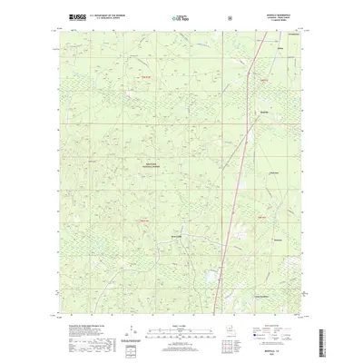
2020 Map of Mudville
USGS Topo · Published 2020About this map
Kisatchie National Forest covers much of this landscape in northern Louisiana, where the rolling elevations of Johns Hills overlook a dense network of bayous and creeks. Small settlements like Breezy Hill and Mudville are connected by a web of local roads, such as Linceum Village Rd and Selma Loop, which reflect the historic rural development of Grant Parish. The geography is defined by its water, from the winding Boston Foot River to the smaller Panther Bayou and Sulphur Cr. For genealogists and local historians, the presence of several burial sites, including Pine Knot Cem, Gray Cem, and McKay Cem, provides specific points of reference for tracing family lineages in this corner of the state near Georgetown.
Find a feature on this map
55 named features on this map. Tap any name to fly to it.
Don’t see what you’re looking for? This feature index may not catch every label — zoom into the map to look around manually.
Map Details
Editions of this 2020 Mudville Map
This is the sole edition of this map. No revisions or reprints were ever made.
Other maps of this area

1932 · Colfax NE
USGS Topo · 1:31,680

1932 · Colfax SE
USGS Topo · 1:31,680

1936 · Colfax
USGS Topo · 1:62,500

1936 · Pollock
USGS Topo · 1:62,500

1941 · Pollock
USGS Topo · 1:62,500

1950 · Winnfield
USGS Topo · 1:62,500

1951 · Winnfield
USGS Topo · 1:62,500

1953 · Alexandria
USGS Topo · 1:250,000

1954 · Tullos
USGS Topo · 1:62,500

1955 · Alexandria
USGS Topo · 1:250,000