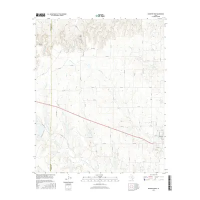
2016 Map of Muenster West
USGS Topo · Published 2016About this map
Muenster serves as the primary hub in this corner of North Texas, situated at the eastern edge of a landscape defined by the upper reaches of the Elm Fork Trinity River. The topography transitions from the lower river valleys toward the distinctive high ground of Devils Backbone and the small settlement at Tyler Bluff. This area, split by the Montague Co and Cooke Co line, reveals a complex drainage network where Brushy Elm Cr, Waller Cr, and Gibbons Br carve through the terrain. The map details a dense rural road system including Powell Ranch Ln and Lutkenhaus Rd, reflecting the enduring ranching and agricultural character of the region. Local landmarks like Squirrel Cr and Dry Elm Cr provide specific reference points for researchers tracing the historical development and land use patterns of these rural Texas counties.
Find a feature on this map
58 named features on this map. Tap any name to fly to it.
Don’t see what you’re looking for? This feature index may not catch every label — zoom into the map to look around manually.
Map Details
Editions of this 2016 Muenster West Map
This is the sole edition of this map. No revisions or reprints were ever made.
Other maps of this area

1902 · Gainesville
USGS Topo · 1:125,000

1905 · Montague
USGS Topo · 1:125,000

1943 · Gainesville
USGS Topo · 1:125,000

1954 · Sherman
USGS Topo · 1:250,000

1958 · Sherman
USGS Topo · 1:250,000

1961 · Muenster West
USGS Topo · 1:24,000

1961 · Saint Jo
USGS Topo · 1:24,000

1961 · Freemound
USGS Topo · 1:24,000

1961 · Hood
USGS Topo · 1:24,000
1961 · Forestburg
USGS Topo · 1:24,000