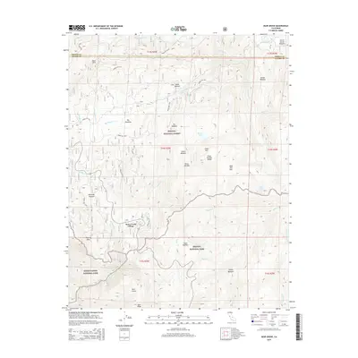
2015 Map of Muir Grove
USGS Topo · Published 2015About this map
Stony Creek Village sits at the heart of this Sierra Nevada landscape, serving as a primary point of human activity where the Sequoia National Forest meets Sequoia National Park. The terrain is defined by a succession of high-altitude basins and clearings, including Big Meadows, Poison Meadow, and Beartrap Meadow, which emphasize the traditional land use of these mountain flats. The topography rises sharply toward the Kings-Kaweah Divide, a significant natural boundary separating the watersheds of the region.
Find a feature on this map
51 named features on this map. Tap any name to fly to it.
Don’t see what you’re looking for? This feature index may not catch every label — zoom into the map to look around manually.
Map Details
Editions of this 2015 Muir Grove Map
This is the sole edition of this map. No revisions or reprints were ever made.
Other maps of this area

1903 · Tehipite
USGS Topo · 1:125,000

1905 · Tehipite
USGS Topo · 1:125,000

1948 · Fresno
USGS Topo · 1:250,000

1952 · Tehipite Dome
USGS Topo · 1:62,500

1953 · Marion Peak
USGS Topo · 1:62,500

1955 · Fresno
USGS Topo · 1:250,000

1956 · Fresno
USGS Topo · 1:250,000

1956 · Giant Forest
USGS Topo · 1:62,500
1956 · Triple Divide Peak
USGS Topo · 1:62,500

1958 · Fresno
USGS Topo · 1:250,000