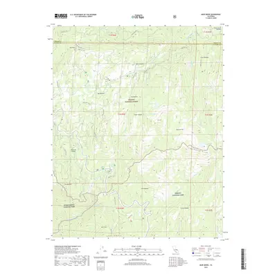
2018 Map of Muir Grove
USGS Topo · Published 2018About this map
Muir Grove stands at the heart of this high-altitude landscape, where the boundaries of three major federal land reserves meet in the High Sierra. This 2018 survey documents the complex geography where Sequoia National Park and Kings Canyon National Park border the Sequoia National Forest. The map centers on the Kings-Kaweah Divide, a massive topographic barrier that separates the drainage of the N Fork Kaweah River from the northern creek systems.
Find a feature on this map
55 named features on this map. Tap any name to fly to it.
Don’t see what you’re looking for? This feature index may not catch every label — zoom into the map to look around manually.
Map Details
Editions of this 2018 Muir Grove Map
This is the sole edition of this map. No revisions or reprints were ever made.
Other maps of this area

1903 · Tehipite
USGS Topo · 1:125,000

1905 · Tehipite
USGS Topo · 1:125,000

1948 · Fresno
USGS Topo · 1:250,000

1952 · Tehipite Dome
USGS Topo · 1:62,500

1953 · Marion Peak
USGS Topo · 1:62,500

1955 · Fresno
USGS Topo · 1:250,000

1956 · Fresno
USGS Topo · 1:250,000

1956 · Giant Forest
USGS Topo · 1:62,500
1956 · Triple Divide Peak
USGS Topo · 1:62,500

1958 · Fresno
USGS Topo · 1:250,000