
1964 Map of Muir Ranch
USGS Topo · Published 1966About this map
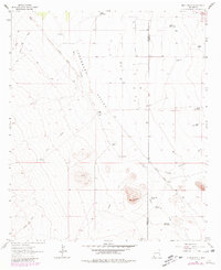
The arid landscape of the Lordsburg Valley dominates this 1964 survey, where the scarcity of water is reflected in the numerous named tanks and catchments that support isolated cattle ranching. Muir Ranch sits at the base of the foothills near the county line between Hidalgo and Grant counties, connected to the wider territory by the Old Railroad Grade. This decommissioned rail line traces a path through the valley floor, once facilitating the transport of cattle and minerals across the high desert flats.
Find a feature on this map
22 named features on this map. Tap any name to fly to it.
Don’t see what you’re looking for? This feature index may not catch every label — zoom into the map to look around manually.
Map Details
Editions of this 1964 Muir Ranch Map
2 editions found
Other maps of this area

1954 · Silver City
USGS Topo · 1:250,000

1958 · Silver City
USGS Topo · 1:250,000

1962 · Silver City
USGS Topo · 1:250,000

1962 · Ninetysix Ranch
USGS Topo · 1:24,000

1962 · Lisbon
USGS Topo · 1:24,000

1963 · Lordsburg
USGS Topo · 1:24,000
1964 · South Pyramid Peak
USGS Topo · 1:24,000

1964 · Pyramid Peak
USGS Topo · 1:24,000
1964 · Separ
USGS Topo · 1:24,000
1964 · Coyote Peak
USGS Topo · 1:24,000