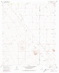
1964 Map of Muir Ranch
USGS Topo · Published 1980About this map
Lordsburg Valley defines this arid landscape in southwestern New Mexico, where life and transit were dictated by the scarce water sources and the terrain of the Hidalgo and Grant county line. The ranching heritage of the area is evident in the naming of Muir Ranch and several family-named water features like Cooper Well and Brockman Dirt Tank. These landmarks point to a time when water management was the primary concern for survival in the high desert.
Find a feature on this map
25 named features on this map. Tap any name to fly to it.
Don’t see what you’re looking for? This feature index may not catch every label — zoom into the map to look around manually.
Map Details
Editions of this 1964 Muir Ranch Map
2 editions found
Other maps of this area

1954 · Silver City
USGS Topo · 1:250,000

1958 · Silver City
USGS Topo · 1:250,000

1962 · Silver City
USGS Topo · 1:250,000

1962 · Ninetysix Ranch
USGS Topo · 1:24,000

1962 · Lisbon
USGS Topo · 1:24,000

1963 · Lordsburg
USGS Topo · 1:24,000

1964 · Muir Ranch
USGS Topo · 1:24,000
1964 · South Pyramid Peak
USGS Topo · 1:24,000

1964 · Pyramid Peak
USGS Topo · 1:24,000
1964 · Separ
USGS Topo · 1:24,000