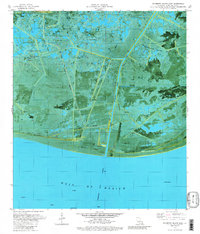
1979 Map of Mulberry Island East
USGS Topo · Published 1980About this map
Freshwater Bayou carves a straight path through the salt marshes of Vermilion Parish in this late 1970s orthophotomap, serving as a critical artery for the region's energy and maritime economy. This coastal landscape is defined by its east-west ridges — elevated cheniers that provide the only firm ground amidst the wetlands. Significant landmarks such as Pecan Island, Mulberry Island, Beef Ridge, and Sand Ridge represent these unique geological features where settlement and industry naturally clustered. The map reveals an intensive industrial footprint with numerous Drill Holes, Sludge Pits, and a sprawling Gas Field situated north of the ridges. Near the shoreline of the Gulf of Mexico, the Freshwater Bayou Channel passes a navigational Lock and several offshore Platforms, while the warning of Masts Exposed near the coast hints at the navigational hazards of this working waterfront.
Find a feature on this map
21 named features on this map. Tap any name to fly to it.
Don’t see what you’re looking for? This feature index may not catch every label — zoom into the map to look around manually.
Map Details
Editions of this 1979 Mulberry Island East Map
This is the sole edition of this map. No revisions or reprints were ever made.
Other maps of this area

1932 · Pecan Island SE
USGS Topo · 1:31,680

1932 · Pecan Island SW
USGS Topo · 1:31,680

1945 · Pecan Island NW
USGS Topo · 1:31,680

1945 · Pecan Island NE
USGS Topo · 1:31,680

1946 · Redfish Point SW
USGS Topo · 1:31,680

1946 · Redfish Point NW
USGS Topo · 1:31,680

1951 · Pecan Island
USGS Topo · 1:62,500

1951 · Cheniere Au Tigre
USGS Topo · 1:62,500
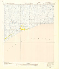
1954 · Redfish Point SW
USGS Topo · 1:31,680
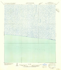
1954 · Pecan Island SW
USGS Topo · 1:31,680