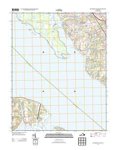
2013 Map of Mulberry Island
USGS Topo · Published 2013About this map
Mulberry Island sits across the wide reach of the James River, where the Warwick River and Pagan River define a landscape shaped by tidal waterways and suburban growth. This 2013 survey illustrates the dense residential expansion on the eastern bank, featuring established communities such as the Mennonite Colony, Warwick Lawns, and Menchville. The mapping of these neighborhoods, alongside smaller enclaves like Boxley Hills and Old Orchard, provides a detailed record of local property development in the early 21st century.
Find a feature on this map
70 named features on this map. Tap any name to fly to it.
Don’t see what you’re looking for? This feature index may not catch every label — zoom into the map to look around manually.
Map Details
Editions of this 2013 Mulberry Island Map
This is the sole edition of this map. No revisions or reprints were ever made.
Other maps of this area

1907 · Norfolk
USGS Topo · 1:125,000

1907 · Yorktown
USGS Topo · 1:62,500

1907 · Hampton
USGS Topo · 1:62,500

1919 · Smithfield
USGS Topo · 1:62,500

1921 · Newport News
USGS Topo · 1:62,500

1943 · Yorktown
USGS Topo · 1:62,500

1943 · Richmond
USGS Topo · 1:250,000

1944 · Yorktown
USGS Topo · 1:24,000

1944 · Morrison
USGS Topo · 1:24,000

1944 · Harris Grove
USGS Topo · 1:24,000