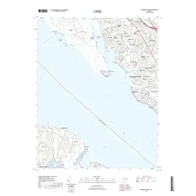
2019 Map of Mulberry Island
USGS Topo · Published 2019About this map
The James River dominates this coastal landscape, serving as a dividing line between Isle Of Wight Co and the bustling developments of Newport News. To the south, the town of Smithfield and Mogarts Beach anchor the shoreline, with Aberdeen Field providing a notable landmark near Days Point. The marshy reaches of Mulberry Island and Swash Hole Island illustrate the complex estuarine environment where Morrisons Creek meets the open water.
Find a feature on this map
156 named features on this map. Tap any name to fly to it.
Don’t see what you’re looking for? This feature index may not catch every label — zoom into the map to look around manually.
Map Details
Editions of this 2019 Mulberry Island Map
This is the sole edition of this map. No revisions or reprints were ever made.
Other maps of this area

1907 · Norfolk
USGS Topo · 1:125,000

1907 · Yorktown
USGS Topo · 1:62,500

1907 · Hampton
USGS Topo · 1:62,500

1919 · Smithfield
USGS Topo · 1:62,500

1921 · Newport News
USGS Topo · 1:62,500

1943 · Yorktown
USGS Topo · 1:62,500

1943 · Richmond
USGS Topo · 1:250,000

1944 · Yorktown
USGS Topo · 1:24,000

1944 · Morrison
USGS Topo · 1:24,000

1944 · Harris Grove
USGS Topo · 1:24,000