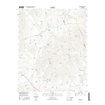
2016 Map of Mulberry
USGS Topo · Published 2016About this map
Mulberry and the surrounding agricultural landscape of Lincoln County define this region of Middle Tennessee. The area is marked by a high density of family cemeteries, including the Sullivan Cem, McDaniel-Parks Cem, and Stephens-Carter Cem, which are invaluable for genealogical research into the families that settled along the forks of Mulberry Creek. The settlement pattern follows the intricate network of hollows and ridges, with names like McGee Hollow and Crystal Ridge reflecting the local topography. To the south, the Elk River winds past Pitts Bend and Dickey Island, crossed by landmarks such as the Cowley Bridge and Shiloh Bridge. Smaller communities like Kelso, Gattistown, and The Quarter provide evidence of early twentieth-century rural development and the importance of waterway crossings such as Lockes Mill.
Find a feature on this map
118 named features on this map. Tap any name to fly to it.
Don’t see what you’re looking for? This feature index may not catch every label — zoom into the map to look around manually.
Map Details
Editions of this 2016 Mulberry Map
This is the sole edition of this map. No revisions or reprints were ever made.
Other maps of this area

1936 · Booneville
USGS Topo · 1:24,000

1936 · Flintville
USGS Topo · 1:24,000

1936 · Cumberland Springs
USGS Topo · 1:24,000

1936 · Belleville
USGS Topo · 1:24,000

1936 · Lincoln
USGS Topo · 1:24,000

1936 · Huntland
USGS Topo · 1:24,000

1936 · Mulberry
USGS Topo · 1:24,000

1936 · Fayetteville
USGS Topo · 1:24,000

1936 · Lois
USGS Topo · 1:24,000

1941 · Cumberland Springs
USGS Topo · 1:24,000