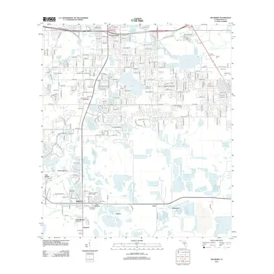
2012 Map of Mulberry
USGS Topo · Published 2012About this map
Mulberry and its surrounding communities are documented here during a period of transition, where residential expansion from Lakeland Highlands meets the industrial and agricultural corridors of central Florida. The landscape is defined by its diverse water bodies, ranging from the large Banana Lake and Crews Lake to smaller features like Six Pound Pond and Crescent Lake. These lakes are interspersed with numerous smaller basins and the headwaters of the N Prong Alafia River.
Find a feature on this map
240 named features on this map. Tap any name to fly to it.
Don’t see what you’re looking for? This feature index may not catch every label — zoom into the map to look around manually.
Map Details
Editions of this 2012 Mulberry Map
This is the sole edition of this map. No revisions or reprints were ever made.
Other maps of this area

1944 · Plant City
USGS Topo · 1:31,680

1944 · Lakeland
USGS Topo · 1:31,680

1944 · Auburndale
USGS Topo · 1:31,680

1949 · Mulberry
USGS Topo · 1:24,000

1949 · Bartow
USGS Topo · 1:24,000

1949 · Bradley Junction
USGS Topo · 1:24,000

1950 · Mulberry
USGS Topo · 1:24,000

1950 · Bartow
USGS Topo · 1:24,000

1950 · Bradley Junction
USGS Topo · 1:24,000

1952 · Homeland
USGS Topo · 1:24,000