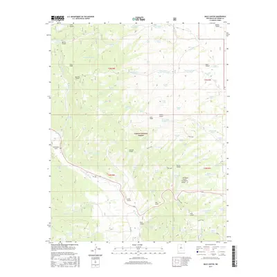
2017 Map of Mule Canyon
USGS Topo · Published 2017About this map
Tusas Ridge and the Tusas Loop define the rugged interior of the Carson National Forest in this northern New Mexico landscape. The map reveals an intricate network of water management features, such as the Mule Canyon Number Three Tank and Barela Number Two Tank, which supported livestock and forestry operations in this arid high-elevation terrain. Evidence of local family history and early land use is found in the scattered namesake landmarks, including Martinez Canyon, Esquibel Canyon, and the small Tusas Cem located near the Rio Tusas.
Find a feature on this map
87 named features on this map. Tap any name to fly to it.
Don’t see what you’re looking for? This feature index may not catch every label — zoom into the map to look around manually.
Map Details
Editions of this 2017 Mule Canyon Map
This is the sole edition of this map. No revisions or reprints were ever made.
Other maps of this area

1918 · Tusas
USGS Topo · 1:125,000

1954 · Raton
USGS Topo · 1:250,000

1954 · Aztec
USGS Topo · 1:250,000

1958 · Raton
USGS Topo · 1:250,000

1958 · Aztec
USGS Topo · 1:250,000

1962 · Aztec
USGS Topo · 1:250,000
1963 · Las Tablas
USGS Topo · 1:24,000

1963 · Broke Off Mountain
USGS Topo · 1:24,000

1963 · Burned Mountain
USGS Topo · 1:24,000
1963 · La Segita Peaks
USGS Topo · 1:24,000