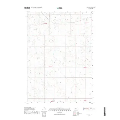
2017 Map of Mule Creek
USGS Topo · Published 2017About this map
Mule Cr winds through the expansive prairie of Haakon County, defining the drainage patterns of this sparsely settled landscape. In this 2017 study, the intricate network of creek beds, including Mitchell Cr and Plum Cr, illustrates the hydrological character of the western South Dakota plains. The survey highlights the intersection of rural infrastructure and natural terrain, where long stretches of unpaved transit like Quinn Rd and Ottumwa Rd traverse the section lines. These roads follow the Public Land Survey System boundaries, specifically across t4n r22e and t5n r23e, showing how late-20th and early-21st-century land management maintains the grid established by early settlers. The presence of Shantu Cr and Deer Cr further emphasizes the reliance on these seasonal waterways in an environment shaped by vast open spaces and limited development.
Find a feature on this map
15 named features on this map. Tap any name to fly to it.
Don’t see what you’re looking for? This feature index may not catch every label — zoom into the map to look around manually.
Map Details
Editions of this 2017 Mule Creek Map
This is the sole edition of this map. No revisions or reprints were ever made.
Other maps of this area

1954 · Pierre
USGS Topo · 1:250,000

1958 · Pierre
USGS Topo · 1:250,000

1983 · Mule Creek
USGS Topo · 1:24,000

1983 · Philip
USGS Topo · 1:100,000

1983 · Moenville
USGS Topo · 1:24,000

1983 · Middle Draw
USGS Topo · 1:24,000

1983 · Powell NW
USGS Topo · 1:24,000

1983 · Tornado Ranch
USGS Topo · 1:24,000
1983 · Ottumwa
USGS Topo · 1:24,000
1983 · Lucerne
USGS Topo · 1:24,000