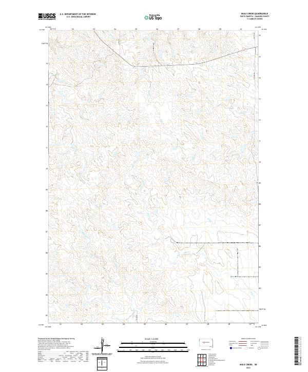
2021 Map of Mule Creek
USGS Topo · Published 2021About this map
The watershed of Mule Cr defines this portion of Haakon County, where a network of seasonal drainages carves into the South Dakota plains. This high-resolution survey captures the modern rural landscape at a scale of 1:24,000, illustrating how the land is divided by the Public Land Survey System through townships such as t4n r22e. The drainage patterns are complex, with Plum Cr and Mitchell Cr creating significant topographical variation across the quadrangle. Human activity is primarily visible through a sparse grid of gravel and section roads, including Quinn Rd and Ottumwa Rd, which facilitate movement between the remote ranches and grazing lands of the West River region. The mapping of Shanty Cr and Deer Cr provides an essential record of water resources in this arid environment.
Find a feature on this map
16 named features on this map. Tap any name to fly to it.
Don’t see what you’re looking for? This feature index may not catch every label — zoom into the map to look around manually.
Map Details
Editions of this 2021 Mule Creek Map
This is the sole edition of this map. No revisions or reprints were ever made.
Other maps of this area

1954 · Pierre
USGS Topo · 1:250,000

1958 · Pierre
USGS Topo · 1:250,000

1983 · Mule Creek
USGS Topo · 1:24,000

1983 · Philip
USGS Topo · 1:100,000

1983 · Moenville
USGS Topo · 1:24,000

1983 · Middle Draw
USGS Topo · 1:24,000

1983 · Powell NW
USGS Topo · 1:24,000

1983 · Tornado Ranch
USGS Topo · 1:24,000
1983 · Ottumwa
USGS Topo · 1:24,000
1983 · Lucerne
USGS Topo · 1:24,000