
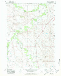
1978 Map of Mule Creek
USGS Topo · Published 1979About this map
Mule Creek and its various branches dominate this high plains landscape in eastern Wyoming during the late 1970s. The terrain is characterized by a network of seasonal watercourses, including Bridge Creek and Jacoby Draw, which carve through the elevations near The Flat Top. Human activity in this rural corner of Niobrara County is primarily defined by resource extraction and sparse ranching infrastructure. Numerous Drill Holes and Oil Wells are scattered across the quadrangle, particularly in the northern and eastern sections, signaling the importance of the energy industry to the local economy. The settlement of Pfister serves as a small anchor point in the southwest, while landmarks like Longley Well and a isolated Water Tank provide critical reference points for navigation across the open country. This survey illustrates the specific land use patterns of the era, where industrial infrastructure like Gravel Pits integrated into a traditional ranching environment.
Find a feature on this map
17 named features on this map. Tap any name to fly to it.
Don’t see what you’re looking for? This feature index may not catch every label — zoom into the map to look around manually.
Map Details
Editions of this 1978 Mule Creek Map
This is the sole edition of this map. No revisions or reprints were ever made.
Other maps of this area

1951 · Twentyone Divide
USGS Topo · 1:24,000

1955 · Newcastle
USGS Topo · 1:250,000

1958 · Newcastle
USGS Topo · 1:250,000

1978 · Riverview
USGS Topo · 1:24,000

1978 · Coffee Flats
USGS Topo · 1:24,000
1978 · Oat Creek NW
USGS Topo · 1:24,000
1978 · Mule Creek SE
USGS Topo · 1:24,000
1981 · Little Alkali Creek
USGS Topo · 1:24,000
1981 · Redbird
USGS Topo · 1:24,000
1981 · Bowen Flat
USGS Topo · 1:24,000