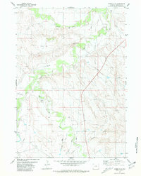
1981 Map of Bowen Flat
USGS Topo · Published 1981About this map
Cheyenne River flows across the northern reaches of this Niobrara County landscape, marking a terrain defined by expansive plateaus and winding seasonal drainages. During the mid-1970s, when these aerial surveys were conducted, the region was characterized by its cattle-ranching utility and emerging energy exploration. The map highlights topographic landmarks like Chimney Rock Butte and the broad expanse of Bowen Flat, which give way to a complex network of draws and creeks. Numerous Drill Hole and Flowing Well labels indicate the active search for resources across Culligans Flats and along the banks of Old Woman Creek. These features, alongside Lance Creek and Jacoby Draw, illustrate the intricate water-management and industrial footprint of this high plains environment.
Find a feature on this map
16 named features on this map. Tap any name to fly to it.
Don’t see what you’re looking for? This feature index may not catch every label — zoom into the map to look around manually.
Map Details
Editions of this 1981 Bowen Flat Map
This is the sole edition of this map. No revisions or reprints were ever made.
Other maps of this area

1955 · Newcastle
USGS Topo · 1:250,000

1958 · Newcastle
USGS Topo · 1:250,000

1978 · Riverview
USGS Topo · 1:24,000

1978 · Mule Creek
USGS Topo · 1:24,000
1978 · Oat Creek NW
USGS Topo · 1:24,000

1981 · Threemile Butte
USGS Topo · 1:24,000
1981 · Little Alkali Creek
USGS Topo · 1:24,000
1981 · Redbird
USGS Topo · 1:24,000
1981 · Buck Creek Hills
USGS Topo · 1:24,000
1981 · Greasewood Creek
USGS Topo · 1:24,000