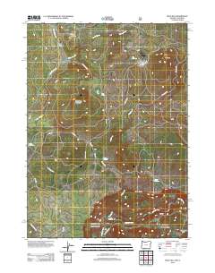
2012 Map of Mule Hill
USGS Topo · Published 2012About this map
The Klamath River carves through the southeastern corner of this terrain, south of the dramatic Klamath Rim. This 2012 survey captures a landscape of significant elevation changes, defined by peaks like Mule Hill and Mud Spring Mountain. A network of unpaved forest and ranch roads, including Dixie Rd and Pokegama Rd, connects remote landmarks and water sources.
Find a feature on this map
26 named features on this map. Tap any name to fly to it.
Don’t see what you’re looking for? This feature index may not catch every label — zoom into the map to look around manually.
Map Details
Editions of this 2012 Mule Hill Map
This is the sole edition of this map. No revisions or reprints were ever made.
Other maps of this area

1886 · Shasta
USGS Topo · 1:250,000

1891 · Ashland
USGS Topo · 1:250,000

1893 · Ashland
USGS Topo · 1:250,000

1894 · Shasta
USGS Topo · 1:250,000

1897 · Ashland
USGS Topo · 1:250,000

1934 · Macdoel
USGS Topo · 1:96,000

1941 · Macdoel
USGS Topo · 1:125,000

1948 · Weed
USGS Topo · 1:250,000

1950 · Weed
USGS Topo · 1:250,000

1954 · Macdoel
USGS Topo · 1:62,500