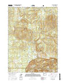
2017 Map of Mule Hill
USGS Topo · Published 2017About this map
Klamath National Forest dominates this landscape along the Oregon and California border, where the Klamath River carves through the southern portion of the quadrangle. The terrain is defined by significant elevations like Mud Spring Mtn and Mule Hill, interspersed with water management features such as Word Reservoir and Griffith Reservoir. For those tracing local history or genealogy, the Way Cem is a notable landmark situated near the junction of several historic routes. A network of primitive and secondary roads, including the Topsy Grade Rd, Pokegama, and Ager Beswick Rd, suggests a legacy of logging or ranching access. From Long Prairie in the northwest to the various springs and drainages like Camp Four Cr, the map documents a transition from high-country meadows to the rugged river canyon below.
Find a feature on this map
33 named features on this map. Tap any name to fly to it.
Don’t see what you’re looking for? This feature index may not catch every label — zoom into the map to look around manually.
Map Details
Editions of this 2017 Mule Hill Map
This is the sole edition of this map. No revisions or reprints were ever made.
Other maps of this area

1886 · Shasta
USGS Topo · 1:250,000

1891 · Ashland
USGS Topo · 1:250,000

1893 · Ashland
USGS Topo · 1:250,000

1894 · Shasta
USGS Topo · 1:250,000

1897 · Ashland
USGS Topo · 1:250,000

1934 · Macdoel
USGS Topo · 1:96,000

1941 · Macdoel
USGS Topo · 1:125,000

1948 · Weed
USGS Topo · 1:250,000

1950 · Weed
USGS Topo · 1:250,000

1954 · Macdoel
USGS Topo · 1:62,500