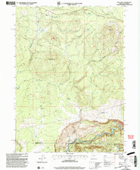
2001 Map of Mule Hill
USGS Topo · Published 2004About this map
The Klamath River carves through the southern landscape of this region, marked by turbulent Rapids and the steep elevation of the Klamath Rim. The terrain is defined by volcanic features and significant water management, including Tom Reservoir, Ward Reservoir, and Griffith Reservoir. Higher elevations are dominated by Mule Hill 5149 and Mud Spring Mountain 4715, which watch over a network of seasonal drainages like Tom Creek and Hayden Creek.
Find a feature on this map
26 named features on this map. Tap any name to fly to it.
Don’t see what you’re looking for? This feature index may not catch every label — zoom into the map to look around manually.
Map Details
Editions of this 2001 Mule Hill Map
This is the sole edition of this map. No revisions or reprints were ever made.
Other maps of this area

1886 · Shasta
USGS Topo · 1:250,000

1891 · Ashland
USGS Topo · 1:250,000

1893 · Ashland
USGS Topo · 1:250,000

1894 · Shasta
USGS Topo · 1:250,000

1897 · Ashland
USGS Topo · 1:250,000

1934 · Macdoel
USGS Topo · 1:96,000

1941 · Macdoel
USGS Topo · 1:125,000

1948 · Weed
USGS Topo · 1:250,000

1950 · Weed
USGS Topo · 1:250,000

1954 · Macdoel
USGS Topo · 1:62,500