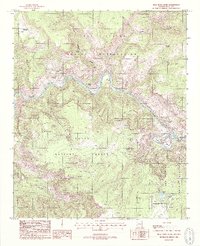
1988 Map of Mule Hoof Bend
USGS Topo · Published 1988About this map
The Salt River carves a deep, winding path through this corner of Gila County, defining the boundaries between the Fort Apache Indian Reservation, the San Carlos Indian Reservation, and the Tonto National Forest. The topography is defined by sharp canyons and significant mineral interests, most notably near the Mule Hoof Bend where numerous mining operations appear. The eastern reach of the river is joined by Cibecue Creek and Coyote Creek, marking a landscape of extreme relief and remote resource extraction.
Find a feature on this map
35 named features on this map. Tap any name to fly to it.
Don’t see what you’re looking for? This feature index may not catch every label — zoom into the map to look around manually.
Map Details
Editions of this 1988 Mule Hoof Bend Map
2 editions found
Other maps of this area

1922 · Chrysotile
USGS Topo · 1:125,000

1946 · Blue House Mtn
USGS Topo · 1:62,500

1951 · Blue House Mtn
USGS Topo · 1:62,500

1954 · Mesa
USGS Topo · 1:250,000

1957 · Mesa
USGS Topo · 1:250,000

1958 · Mesa
USGS Topo · 1:250,000

1960 · Mesa
USGS Topo · 1:250,000

1964 · Mesa
USGS Topo · 1:250,000

1966 · Brushy Canyon
USGS Topo · 1:24,000
1966 · Haystack Butte
USGS Topo · 1:24,000