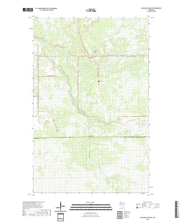
2022 Map of Mulligan Lake SW
USGS Topo · Published 2022About this map
The small settlement of Winner anchors this 2022 survey of northern Minnesota, situated at the junction of Winner Forest Rd and the Bemis Hill Trails Trl. This landscape is defined by its low-lying hydrology, where the Roseau River and Hansen Cr navigate through a dense network of wetlands and forested tracts. The map reveals a remote area primarily utilized for timber and recreation, as evidenced by the extensive trail networks including the Fourtown-Grygla Trails System Trl. Local heritage is represented by the Elkwood Cem, a rare named landmark in a region otherwise dominated by section lines and natural features. The transition between Roseau and Beltrami counties is clearly marked, illustrating the political geography across this marshy northern terrain.
Find a feature on this map
16 named features on this map. Tap any name to fly to it.
Don’t see what you’re looking for? This feature index may not catch every label — zoom into the map to look around manually.
Map Details
Editions of this 2022 Mulligan Lake SW Map
This is the sole edition of this map. No revisions or reprints were ever made.
Other maps of this area

1918 · Pencer
USGS Topo · 1:62,500

1918 · Malcolm
USGS Topo · 1:62,500

1919 · Liner
USGS Topo · 1:62,500

1954 · Roseau
USGS Topo · 1:250,000

1957 · Roseau
USGS Topo · 1:250,000

1958 · Roseau
USGS Topo · 1:250,000
1967 · Wannaska NE
USGS Topo · 1:24,000

1968 · Mulligan Lake SW
USGS Topo · 1:24,000
1968 · Mulligan Lake NE
USGS Topo · 1:24,000
1968 · Mulligan Lake NW
USGS Topo · 1:24,000