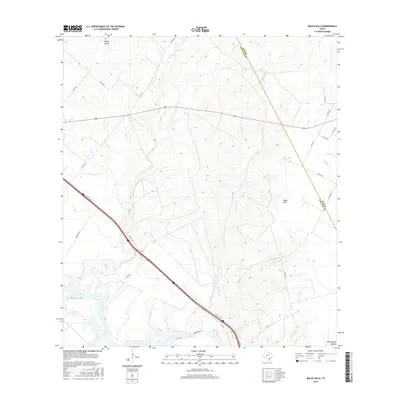
2016 Map of Mulos Hills
USGS Topo · Published 2016About this map
Lake Corpus Christi defines the southwestern edge of this South Texas landscape, where the waters meet the winding drainages of La Para Cr and Mustang Cr. The topography is shaped by the prominent Mulos Hills, which rise above a network of county roads and regional thoroughfares including FM 1596 and FM 3024. This area on the Bee and Live Oak county line is characterized by significant relief, visible in named landforms like Hailey Hollow and Weathersby Hollow. The map reveals a rural infrastructure of private lanes and cattle-country roads, such as Antelope Rd and 2 Brothers Ln, supporting the sprawling ranchlands typical of the coastal bend interior. The placement of N Hwy 37 Acc provides a clear view of the modern transportation corridor cutting through these traditional grazing lands.
Find a feature on this map
29 named features on this map. Tap any name to fly to it.
Don’t see what you’re looking for? This feature index may not catch every label — zoom into the map to look around manually.
Map Details
Editions of this 2016 Mulos Hills Map
This is the sole edition of this map. No revisions or reprints were ever made.
Other maps of this area

1920 · Mikeska
USGS Topo · 1:125,000

1925 · Oakville No. 4
USGS Topo · 1:48,000

1925 · Mathis No. 2
USGS Topo · 1:48,000

1927 · Mathis
USGS Topo · 1:62,500

1927 · Oakville
USGS Topo · 1:62,500

1953 · Crystal City
USGS Topo · 1:250,000

1953 · Beeville
USGS Topo · 1:250,000

1954 · Fleming
USGS Topo · 1:62,500

1954 · Mathis
USGS Topo · 1:62,500

1955 · Crystal City
USGS Topo · 1:250,000