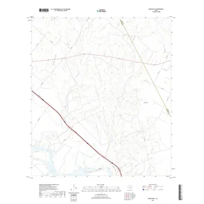
2019 Map of Mulos Hills
USGS Topo · Published 2019About this map
Lake Corpus Christi anchors the southern boundary of this landscape along the Bee Co and Live Oak Co line. The terrain is defined by a series of intermittent drainages including La Para Cr and Mustang Cr which flow toward the reservoir. High points like the Mulos Hills and the depression of Hailey Hollow characterize the upland areas north of the water. The map shows a transition from rural county roads such as Co RD 339 to more established state routes like FM 1596 and FM 534. A small collection of local access points, including Pvt Dam Rd and 2 Brothers Ln, cluster near the lakeshore, indicating the intersection of water access and local ranching or residential transit in this South Texas borderland.
Find a feature on this map
24 named features on this map. Tap any name to fly to it.
Don’t see what you’re looking for? This feature index may not catch every label — zoom into the map to look around manually.
Map Details
Editions of this 2019 Mulos Hills Map
This is the sole edition of this map. No revisions or reprints were ever made.
Other maps of this area

1920 · Mikeska
USGS Topo · 1:125,000

1925 · Oakville No. 4
USGS Topo · 1:48,000

1925 · Mathis No. 2
USGS Topo · 1:48,000

1927 · Mathis
USGS Topo · 1:62,500

1927 · Oakville
USGS Topo · 1:62,500

1953 · Crystal City
USGS Topo · 1:250,000

1953 · Beeville
USGS Topo · 1:250,000

1954 · Fleming
USGS Topo · 1:62,500

1954 · Mathis
USGS Topo · 1:62,500

1955 · Crystal City
USGS Topo · 1:250,000