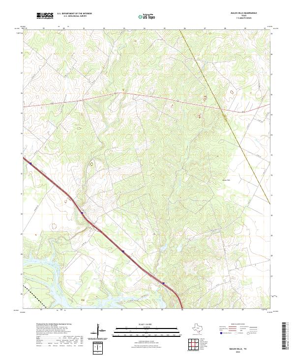
2022 Map of Mulos Hills
USGS Topo · Published 2022About this map
The Nueces River winds through the southern edge of this South Texas landscape, where the coastal plain meets the brush country. The terrain is defined by the elevation of the Mulos Hills and the drainage patterns of significant local waterways like Mustang Cr, La Para Cr, and Elm Cr. A network of rural county roads and farm-to-market routes crisscross the region, highlighting the importance of cattle ranching and land access in this part of Live Oak Co. The map also captures the path of the N Hwy 37 Acc corridor as it cuts through the territory, marking a modern transition across the older topographic features of Hailey Hollow. For those studying the boundary history of the area, the sheet clearly delineates the border between Live Oak County and Bee County.
Find a feature on this map
25 named features on this map. Tap any name to fly to it.
Don’t see what you’re looking for? This feature index may not catch every label — zoom into the map to look around manually.
Map Details
Editions of this 2022 Mulos Hills Map
This is the sole edition of this map. No revisions or reprints were ever made.
Other maps of this area

1920 · Mikeska
USGS Topo · 1:125,000

1925 · Oakville No. 4
USGS Topo · 1:48,000

1925 · Mathis No. 2
USGS Topo · 1:48,000

1927 · Mathis
USGS Topo · 1:62,500

1927 · Oakville
USGS Topo · 1:62,500

1953 · Crystal City
USGS Topo · 1:250,000

1953 · Beeville
USGS Topo · 1:250,000

1954 · Fleming
USGS Topo · 1:62,500

1954 · Mathis
USGS Topo · 1:62,500

1955 · Crystal City
USGS Topo · 1:250,000