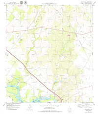
1979 Map of Mulos Hills
USGS Topo · Published 1979About this map
Lake Corpus Christi and the Nueces River dominate the southwestern corner of this South Texas landscape, where the coastal plain begins its gradual rise into the Mulos Hills. The late 1970s environment is defined by a mix of ranching and resource extraction, with numerous Gravel Pits and oil wells scattered across the brush country. The Missouri Pacific railroad tracks parallel the river valley, serving as a primary transportation artery near the local Roadside Park.
Find a feature on this map
23 named features on this map. Tap any name to fly to it.
Don’t see what you’re looking for? This feature index may not catch every label — zoom into the map to look around manually.
Map Details
Editions of this 1979 Mulos Hills Map
This is the sole edition of this map. No revisions or reprints were ever made.
Other maps of this area

1920 · Mikeska
USGS Topo · 1:125,000

1925 · Oakville No. 4
USGS Topo · 1:48,000

1925 · Mathis No. 2
USGS Topo · 1:48,000

1927 · Mathis
USGS Topo · 1:62,500

1927 · Oakville
USGS Topo · 1:62,500

1953 · Crystal City
USGS Topo · 1:250,000

1953 · Beeville
USGS Topo · 1:250,000

1954 · Fleming
USGS Topo · 1:62,500

1954 · Mathis
USGS Topo · 1:62,500

1955 · Crystal City
USGS Topo · 1:250,000