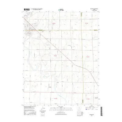
2015 Map of Mulvane
USGS Topo · Published 2015About this map
The Arkansas River carves a winding path through the center of this landscape, marking a significant hydrological and agricultural boundary where four counties meet: Sedgwick, Sumner, Butler, and Cowley. The city of Mulvane sits at the northwestern convergence of these borders, showing a developed street grid that includes E Mulvane St and Rockwood Blvd. To the southeast, the smaller settlement of Udall anchors the corner of Cowley County, surrounded by fertile plains drained by numerous tributaries like Bitter Cr and Antelope Cr.
Find a feature on this map
85 named features on this map. Tap any name to fly to it.
Don’t see what you’re looking for? This feature index may not catch every label — zoom into the map to look around manually.
Map Details
Editions of this 2015 Mulvane Map
This is the sole edition of this map. No revisions or reprints were ever made.
Other maps of this area

1889 · Wichita
USGS Topo · 1:125,000

1890 · Wellington
USGS Topo · 1:125,000

1894 · Wichita
USGS Topo · 1:125,000

1943 · Derby
USGS Topo · 1:31,680

1955 · Udall
USGS Topo · 1:24,000

1955 · Belle Plaine
USGS Topo · 1:24,000

1955 · Rose Hill
USGS Topo · 1:24,000

1955 · Mulvane
USGS Topo · 1:24,000

1955 · Douglass
USGS Topo · 1:24,000

1955 · Wichita
USGS Topo · 1:250,000