2022 Map of Mulvane
USGS Topo · Published 2022About this map
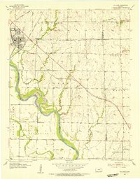
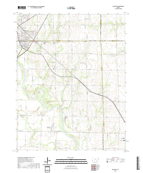
The Arkansas River meanders through this portion of south-central Kansas, carving a wide valley that defines the landscape where Mulvane sits at the intersection of four counties. This survey illustrates a rural-agricultural corridor transitioning into suburban expansion, particularly around the northern settlement of Mulvane with its residential developments like Country Walk Ln and Rockwood Blvd. Local history and genealogy are anchored by several burying grounds, including Mulvane Cem, Littleton Cem, and Udall Cem. The area’s aviation character is noted by private landing strips such as Rogers Airport and Belle Plaine Farms Airport. Beyond the main river, the terrain is drained by numerous small tributaries including Bitter Cr, Short Cr, and Antelope Cr, which cut through the surrounding fields and pastures.
Find a feature on this map
53 named features on this map. Tap any name to fly to it.
Don’t see what you’re looking for? This feature index may not catch every label — zoom into the map to look around manually.
Map Details
Editions of this 2022 Mulvane Map
This is the sole edition of this map. No revisions or reprints were ever made.