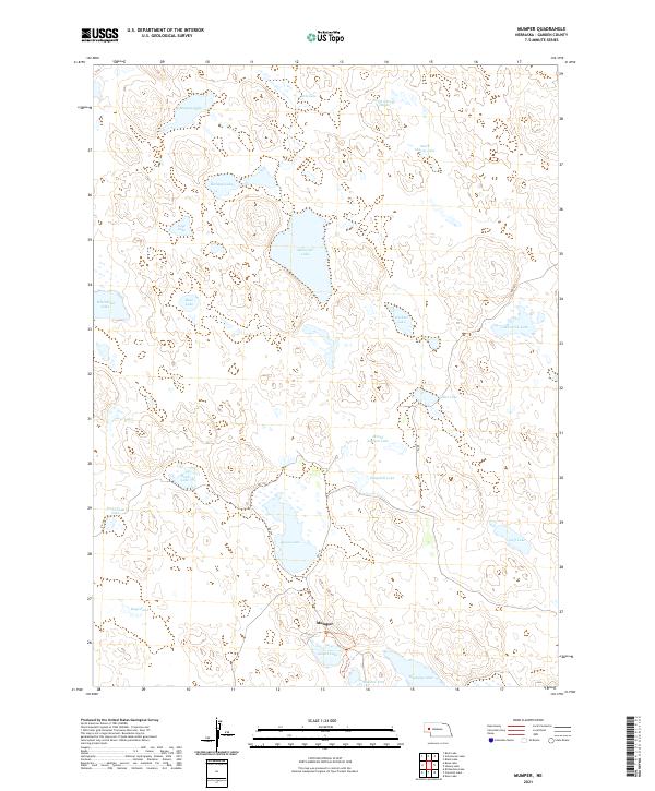
2021 Map of Mumper
USGS Topo · Published 2021About this map
Mumper serves as the central focal point of this Nebraska Sandhills landscape, situated amidst a dense network of seasonal and permanent water bodies. The terrain is defined by a high concentration of named lakes, including the expansive Ashburger Lake and the clustered North Cherry Lakes and South Cherry Lake. This distribution of water features, including School Section Lake and Goose Lake, suggests a complex hydrologic environment typical of Garden County's ranching country. Transportation is maintained through a series of rural routes such as RD 181 and RD 110, while the Nature Trl near Gimlet Lake indicates the area's recreational or conservation value. The presence of Tree Claim Lake provides a glimpse into the region's homesteading history, where early settlers planted trees to secure land titles under federal law. Other distinctive features like Mallard Arm and Roundup Lake further characterize the local geography.
Find a feature on this map
32 named features on this map. Tap any name to fly to it.
Don’t see what you’re looking for? This feature index may not catch every label — zoom into the map to look around manually.
Map Details
Editions of this 2021 Mumper Map
This is the sole edition of this map. No revisions or reprints were ever made.
Other maps of this area

1896 · Browns Creek
USGS Topo · 1:125,000

1899 · Browns Creek
USGS Topo · 1:125,000

1949 · Mumper
USGS Topo · 1:62,500

1950 · Crescent Lake
USGS Topo · 1:62,500

1950 · Storm Lake
USGS Topo · 1:62,500

1954 · Scottsbluff
USGS Topo · 1:250,000

1958 · Scottsbluff
USGS Topo · 1:250,000

1971 · Richardson Lake
USGS Topo · 1:24,000

1985 · Crescent Lake
USGS Topo · 1:100,000
1986 · Hessey Lake
USGS Topo · 1:24,000