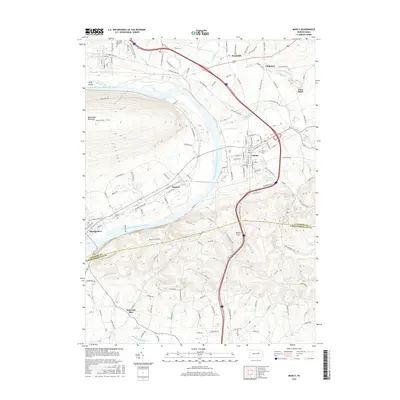
2016 Map of Muncy
USGS Topo · Published 2016About this map
The West Branch Susquehanna River carves a sweeping path through this Lycoming and Northumberland County landscape, serving as the central artery between the borough of Muncy and the town of Montgomery. The terrain transitions from the steep, forested slopes of Bald Eagle Mountain and the Muncy Hills to the fertile river valleys where settlements like Pennsdale, Saegers, and Chippewa are established. This 2016 survey captures a mix of longstanding agricultural land and modern infrastructure, including the Muncy Reservoir and the commercial corridor along Lycoming Mall Dr. Genealogists will find notable burial grounds including Twin Hills Memorial Park, Muncy Cem, and Clinton Cem clearly marked. The map details an intricate network of runs and creeks, such as Muncy Creek, Warrior Run, and Wolf Run, which have historically dictated the placement of early roads and homesteads throughout the region.
Find a feature on this map
134 named features on this map. Tap any name to fly to it.
Don’t see what you’re looking for? This feature index may not catch every label — zoom into the map to look around manually.
Map Details
Editions of this 2016 Muncy Map
This is the sole edition of this map. No revisions or reprints were ever made.
Other maps of this area

1924 · Milton
USGS Topo · 1:62,500

1927 · Eagles Mere
USGS Topo · 1:48,000

1930 · Warrensville
USGS Topo · 1:62,500

1932 · Eagle Mere
USGS Topo · 1:62,500

1934 · Warrensville
USGS Topo · 1:62,500

1935 · Hughesville
USGS Topo · 1:62,500

1953 · Hughesville
USGS Topo · 1:62,500

1953 · Warrensville
USGS Topo · 1:62,500

1953 · Eagles Mere
USGS Topo · 1:62,500

1953 · Milton
USGS Topo · 1:62,500
Featured Places
- Lewis Township, PA
- Lime Bluff, Muncy Creek Township
- Saegers, Clinton Township
- Muncy Township, PA
- Fairfield Township, PA