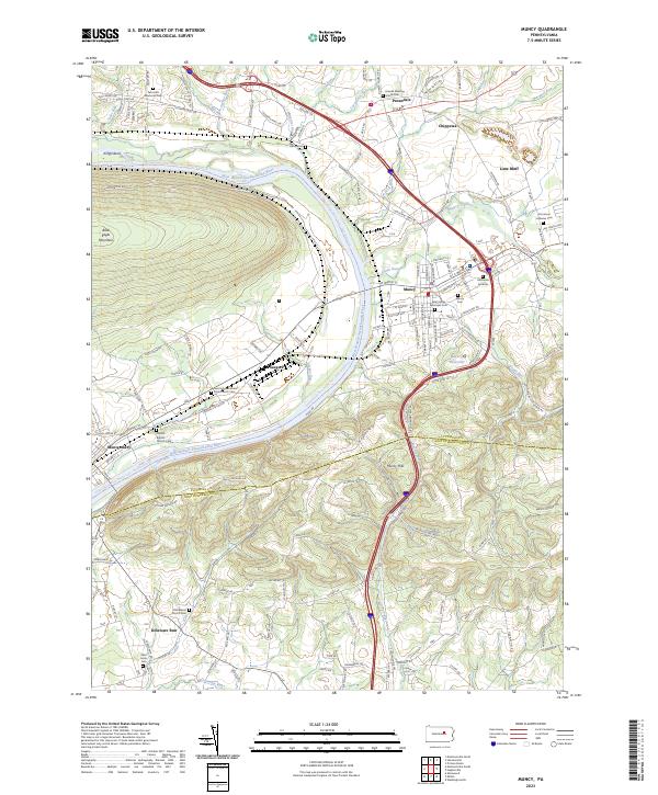
2023 Map of Muncy
USGS Topo · Published 2023About this map
The West Branch Susquehanna River carves a deep valley between the steep slopes of Bald Eagle Mountain and the rolling Muncy Hills, defining the development of this Lycoming County corridor. The borough of Muncy serves as a focal point, characterized by its grid of streets and numerous historical sites, including the Muncy Cem and Hill Burial Grounds. The landscape transition from riverbottom to highland is marked by smaller settlements like Saegers, Lime Bluff, and Pennsdale, where the Friends Meeting House stands as a local landmark.
Find a feature on this map
154 named features on this map. Tap any name to fly to it.
Don’t see what you’re looking for? This feature index may not catch every label — zoom into the map to look around manually.
Map Details
Editions of this 2023 Muncy Map
This is the sole edition of this map. No revisions or reprints were ever made.
Other maps of this area

1924 · Milton
USGS Topo · 1:62,500

1927 · Eagles Mere
USGS Topo · 1:48,000

1930 · Warrensville
USGS Topo · 1:62,500

1932 · Eagle Mere
USGS Topo · 1:62,500

1934 · Warrensville
USGS Topo · 1:62,500

1935 · Hughesville
USGS Topo · 1:62,500

1953 · Hughesville
USGS Topo · 1:62,500

1953 · Warrensville
USGS Topo · 1:62,500

1953 · Eagles Mere
USGS Topo · 1:62,500

1953 · Milton
USGS Topo · 1:62,500
Featured Places
- Delaware Township, PA
- Muncy Creek Township, PA
- Clinton Township, PA
- Lewis Township, PA
- Chippewa, Muncy Township