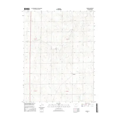
2015 Map of Munden
USGS Topo · Published 2015About this map
Munden serves as the primary settlement hub in this section of Republic County, situated within a landscape defined by the drainage patterns of Rose Cr, Salt Cr, and N Fork Mill Cr. This portion of north-central Kansas exhibits a strictly organized section-line road grid, with local thoroughfares like Birch Rd, Cedar, and Elm tracing the boundaries of historical townships including t1s r2w and t1s r3w. A notable site for local genealogy is the Rose Creek Cem, located centrally along Elm Rd. The map illustrates a rural economy dependent on these transportation corridors, including highway 81 on the western edge, which connects the isolated farmsteads and agricultural plots that comprise the majority of the terrain.
Find a feature on this map
27 named features on this map. Tap any name to fly to it.
Don’t see what you’re looking for? This feature index may not catch every label — zoom into the map to look around manually.
Map Details
Editions of this 2015 Munden Map
This is the sole edition of this map. No revisions or reprints were ever made.
Other maps of this area

1892 · Concordia
USGS Topo · 1:125,000

1893 · Washington
USGS Topo · 1:125,000

1898 · Hebron
USGS Topo · 1:125,000

1955 · Manhattan
USGS Topo · 1:250,000

1955 · Lincoln
USGS Topo · 1:250,000

1956 · Manhattan
USGS Topo · 1:250,000

1957 · Manhattan
USGS Topo · 1:250,000

1957 · Lincoln
USGS Topo · 1:250,000

1958 · Lincoln
USGS Topo · 1:250,000

1960 · Chester
USGS Topo · 1:24,000