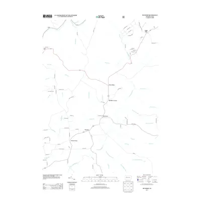
2013 Map of Munderf
USGS Topo · Published 2013About this map
Hays Lookout Tower overlooks a landscape defined by the branching tributaries of the N Fork Redbank Cr in this rural stretch of Jefferson County. The network of small settlements, including Munderf, Dixon Corner, and Blowtown, are connected by winding township roads like Munderf Rd and Dixon Rd. The terrain is deeply etched by numerous named drainages such as Callen Run, Windfall Run, and Stony Run, which dictate the placement of local homesteads and historical land use. In the northeast corner, Lake City and Swedetown Rd suggest patterns of ethnic settlement near Lake City Run. These intersections and small named corners like Schoffner Corner provide critical landmarks for genealogists tracing family locations in Warsaw Township during the early twenty-first century.
Find a feature on this map
83 named features on this map. Tap any name to fly to it.
Don’t see what you’re looking for? This feature index may not catch every label — zoom into the map to look around manually.
Map Details
Editions of this 2013 Munderf Map
This is the sole edition of this map. No revisions or reprints were ever made.
Other maps of this area

1918 · Loleta
USGS Topo · 1:62,500

1922 · Du Bois
USGS Topo · 1:62,500

1924 · Du Bois
USGS Topo · 1:62,500

1924 · Brookville
USGS Topo · 1:62,500

1926 · Brookville
USGS Topo · 1:62,500

1936 · Marienville
USGS Topo · 1:48,000

1940 · Hallton
USGS Topo · 1:48,000

1941 · Marienville
USGS Topo · 1:62,500

1943 · Hallton
USGS Topo · 1:62,500

1944 · Du Bois
USGS Topo · 1:62,500
Featured Places
- Warsaw Township, PA
- Millstone Township, PA
- Spring Creek Township, PA
- Blowtown, Polk Township
- Green Briar, Polk Township