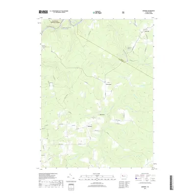
2019 Map of Munderf
USGS Topo · Published 2019About this map
Allegheny National Forest and the Clarion Wild and Scenic River define the northwestern corner of this Jefferson County landscape. The terrain is a complex network of deep-cut drainage basins including North Fork Redbank Creek and Cullen Run. Small settlements such as Munderf, Lake City, and Blowtown are scattered across the uplands, connected by a dense web of local routes like Mcneil Station Rd and Log Cabin Rd. This modern survey illustrates the persistent rural character of the region, where family history is anchored at the Munderf Cem and Lake City Cem. The transition from the protected forest lands in the north to the managed woodlots and clearings around Green Briar shows how the geography remains centered on the natural resources of the Pennsylvania wilds.
Find a feature on this map
70 named features on this map. Tap any name to fly to it.
Don’t see what you’re looking for? This feature index may not catch every label — zoom into the map to look around manually.
Map Details
Editions of this 2019 Munderf Map
This is the sole edition of this map. No revisions or reprints were ever made.
Other maps of this area

1918 · Loleta
USGS Topo · 1:62,500

1922 · Du Bois
USGS Topo · 1:62,500

1924 · Du Bois
USGS Topo · 1:62,500

1924 · Brookville
USGS Topo · 1:62,500

1926 · Brookville
USGS Topo · 1:62,500

1936 · Marienville
USGS Topo · 1:48,000

1940 · Hallton
USGS Topo · 1:48,000

1941 · Marienville
USGS Topo · 1:62,500

1943 · Hallton
USGS Topo · 1:62,500

1944 · Du Bois
USGS Topo · 1:62,500
Featured Places
- Warsaw Township, PA
- Millstone Township, PA
- Spring Creek Township, PA
- Blowtown, Polk Township
- Green Briar, Polk Township