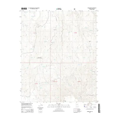
2014 Map of Munds Draw
USGS Topo · Published 2014About this map
Woodchute Mtn and the high desert ridges of the Black Hills define this Yavapai County landscape, where water management is the primary marker of human activity. Managed by the Prescott National Forest, the region is dotted with dozens of earthen water catchments, ranging from the China Dam Tank to the CCC Tank, reflecting the long-standing importance of livestock grazing in the Arizona backcountry.
Find a feature on this map
43 named features on this map. Tap any name to fly to it.
Don’t see what you’re looking for? This feature index may not catch every label — zoom into the map to look around manually.
Map Details
Editions of this 2014 Munds Draw Map
This is the sole edition of this map. No revisions or reprints were ever made.
Other maps of this area

1887 · Prescott
USGS Topo · 1:250,000

1892 · Prescott
USGS Topo · 1:250,000

1905 · Jerome
USGS Topo · 1:125,000

1944 · Clarkdale
USGS Topo · 1:48,000

1944 · Mingus Mountain
USGS Topo · 1:62,500

1947 · Mingus Mtn
USGS Topo · 1:62,500

1947 · Paulden
USGS Topo · 1:62,500

1947 · Prescott
USGS Topo · 1:62,500

1948 · Prescott
USGS Topo · 1:62,500
1948 · Clarkdale
USGS Topo · 1:62,500