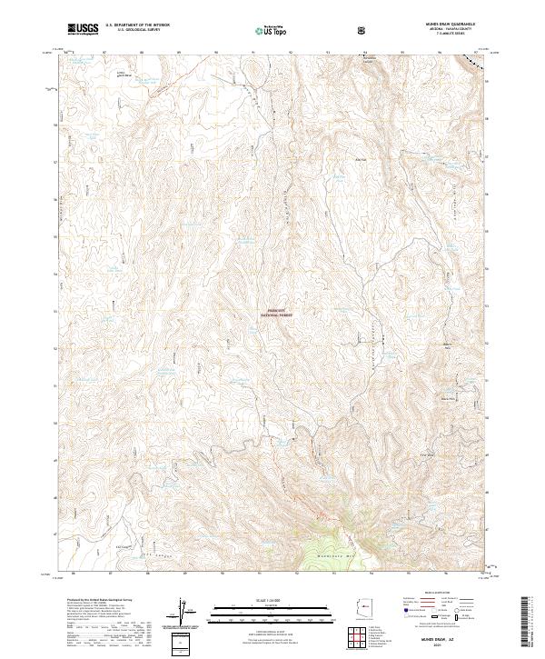
2021 Map of Munds Draw
USGS Topo · Published 2021About this map
Prescott National Forest dominates this Yavapai County landscape, defined by a complex network of draws and canyons used for decades to manage water in an arid environment. The map reveals an intricate system of tanks and springs essential for livestock and local land use, including named water sources such as China Dam Tank, Elderberry Spring, and the curiously named Narrow Gauge Tank. From the high point at Woodchute Mountain in the south to the northern expanse of Little Black Mesa, the terrain is etched by several prominent drainages like Munds Draw and Horseshoe Canyon. Traceable routes such as the Black Mesa Trail and Woodchute Trail provide passage through the upland forest and past features like First View and Bakers Pass. This 2021 survey documents the historical persistence of these remote water improvements, from the CCC Tank to the Section House Spring, within the context of federal forest management.
Find a feature on this map
53 named features on this map. Tap any name to fly to it.
Don’t see what you’re looking for? This feature index may not catch every label — zoom into the map to look around manually.
Map Details
Editions of this 2021 Munds Draw Map
This is the sole edition of this map. No revisions or reprints were ever made.
Other maps of this area

1887 · Prescott
USGS Topo · 1:250,000

1892 · Prescott
USGS Topo · 1:250,000

1905 · Jerome
USGS Topo · 1:125,000

1944 · Clarkdale
USGS Topo · 1:48,000

1944 · Mingus Mountain
USGS Topo · 1:62,500

1947 · Mingus Mtn
USGS Topo · 1:62,500

1947 · Paulden
USGS Topo · 1:62,500

1947 · Prescott
USGS Topo · 1:62,500

1948 · Prescott
USGS Topo · 1:62,500
1948 · Clarkdale
USGS Topo · 1:62,500