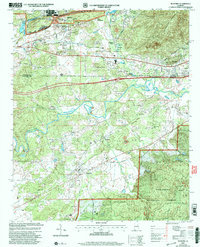
2001 Map of Munford
USGS Topo · Published 2004About this map
Munford and its surrounding rural landscapes in Calhoun and Talladega counties are defined by the convergence of industrial military activity and protected woodlands. The sprawling Anniston Army Depot dominates the northwestern corner near Bynum, while the southeastern portion of the map transitions into the dense reaches of the Talladega National Forest. The hydrological network is anchored by Choccolocco Creek, which winds through a valley populated by several small settlements and community landmarks, including Jenifer and the State Fish Hatchery.
Find a feature on this map
32 named features on this map. Tap any name to fly to it.
Don’t see what you’re looking for? This feature index may not catch every label — zoom into the map to look around manually.
Map Details
Editions of this 2001 Munford Map
This is the sole edition of this map. No revisions or reprints were ever made.
Other maps of this area

1889 · Springville
USGS Topo · 1:125,000

1890 · Talladega
USGS Topo · 1:125,000

1891 · Ashland
USGS Topo · 1:125,000

1892 · Springville
USGS Topo · 1:125,000

1892 · Talladega
USGS Topo · 1:125,000

1900 · Anniston
USGS Topo · 1:125,000

1943 · Talladega
USGS Topo · 1:62,500

1946 · Talladega
USGS Topo · 1:62,500

1947 · Oxford
USGS Topo · 1:24,000

1947 · Anniston
USGS Topo · 1:24,000