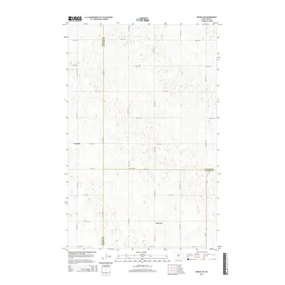
2014 Map of Munich SW
USGS Topo · Published 2014About this map
Salem Cem serves as a central landmark in this rural landscape at the meeting point of Towner, Cavalier, and Ramsey counties. This 2014 survey captures a quiet agricultural expanse defined by a strict section-line road grid, including 79th St NE and 75th St NE. The small settlements of Newville and Saint Joe are situated among numerous prairie potholes and seasonal wetlands, illustrating the glacial topography characteristic of this part of North Dakota. These scattered water bodies break the regularity of the farmland, creating a complex drainage pattern across the triple-county boundary. The map reflects a modern era of rural life where legacy names like Newville persist alongside a precisely maintained infrastructure of county roads and agricultural boundaries.
Find a feature on this map
14 named features on this map. Tap any name to fly to it.
Don’t see what you’re looking for? This feature index may not catch every label — zoom into the map to look around manually.
Map Details
Editions of this 2014 Munich SW Map
This is the sole edition of this map. No revisions or reprints were ever made.
Other maps of this area

1953 · Devils Lake
USGS Topo · 1:250,000

1956 · Devils Lake
USGS Topo · 1:250,000

1957 · Cando NE
USGS Topo · 1:24,000

1962 · Egeland SE
USGS Topo · 1:24,000

1962 · Starkweather
USGS Topo · 1:24,000

1962 · Egeland
USGS Topo · 1:24,000

1962 · Starkweather NE
USGS Topo · 1:24,000

1970 · Munich
USGS Topo · 1:24,000

1971 · Calio
USGS Topo · 1:24,000

1971 · Munich SW
USGS Topo · 1:24,000