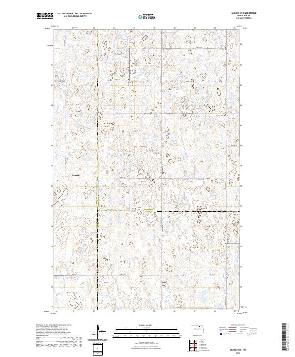
2024 Map of Munich SW
USGS Topo · Published 2024About this map
Glacial prairie potholes and small wetlands dominate this landscape at the intersection of Towner, Cavalier, and Ramsey counties. The small settlements of Calio, Newville, and Saint Joe are connected by a precise grid of rural roads, including the Towner-Cavalier Co Line Rd, which follows the north-south section lines. This pattern of land use reflects the enduring structure of the Public Land Survey System, with township boundaries like t159n r65w and t158n r64w defining the region's organization. In the northern section, the Cavalier County Waterfowl Production Area preserves a portion of the native terrain, while the Salem Cem stands as a quiet focal point for local genealogy along the southern border of Cavalier County. The map provides a detailed look at the rural drainage patterns and agricultural layout of this corner of the state.
Find a feature on this map
22 named features on this map. Tap any name to fly to it.
Don’t see what you’re looking for? This feature index may not catch every label — zoom into the map to look around manually.
Map Details
Editions of this 2024 Munich SW Map
This is the sole edition of this map. No revisions or reprints were ever made.
Other maps of this area

1953 · Devils Lake
USGS Topo · 1:250,000

1956 · Devils Lake
USGS Topo · 1:250,000

1957 · Cando NE
USGS Topo · 1:24,000

1962 · Egeland SE
USGS Topo · 1:24,000

1962 · Starkweather
USGS Topo · 1:24,000

1962 · Egeland
USGS Topo · 1:24,000

1962 · Starkweather NE
USGS Topo · 1:24,000

1970 · Munich
USGS Topo · 1:24,000

1971 · Calio
USGS Topo · 1:24,000

1971 · Munich SW
USGS Topo · 1:24,000