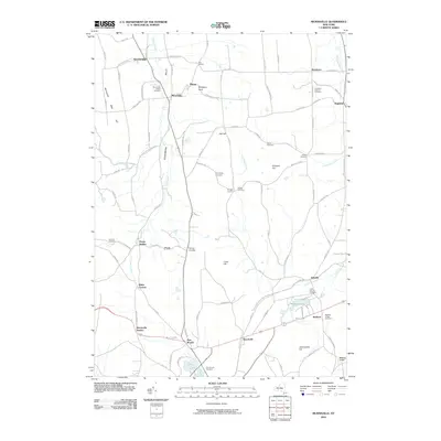
2010 Map of Munnsville
USGS Topo · Published 2010About this map
Oneida Creek and Blue Creek carve through the center of this rural Madison County landscape, defining a corridor once heavily reliant on the Valley and Stockbridge rail lines. The settlement patterns reflect a history of crossroads hamlets, where places like Bouckville, Solsville, and Morrisville Station grew along established transport routes. The geography is punctuated by significant local heights such as Johnnycake Hill and Crow Hill, which overlook the surrounding agricultural tracts and clustered homesteads.
Find a feature on this map
97 named features on this map. Tap any name to fly to it.
Don’t see what you’re looking for? This feature index may not catch every label — zoom into the map to look around manually.
Map Details
Editions of this 2010 Munnsville Map
This is the sole edition of this map. No revisions or reprints were ever made.
Other maps of this area

1895 · Oriskany
USGS Topo · 1:62,500

1895 · Oneida
USGS Topo · 1:62,500

1898 · Oneida
USGS Topo · 1:62,500

1898 · Oriskany
USGS Topo · 1:62,500

1902 · Morrisville
USGS Topo · 1:62,500

1902 · Oneida
USGS Topo · 1:62,500

1907 · Sangerfield
USGS Topo · 1:62,500

1939 · Oneida
USGS Topo · 1:62,500

1943 · West Eaton
USGS Topo · 1:24,000

1943 · Morrisville
USGS Topo · 1:24,000