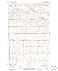
1949 Map of Munster
USGS Topo · Published 1986About this map
The James River meanders across the northern section of this landscape, carving a distinct valley through the prairie of Wells and Eddy Counties. The small settlement of Munster serves as a focal point along the Burlington Northern railroad, which parallels the river's course. This mid-century survey reveals a highly organized rural infrastructure, divided into townships such as Bremen, Fairville, and Field. The distribution of School No 1 and School No 2 across these townships illustrates the established network of one-room schoolhouses that once anchored this agricultural community. The terrain is characterized by a high density of small potholes and depressions, typical of the glaciated plains, which dictated the placement of early farmsteads and transport routes away from the lowest, most saturated ground.
Find a feature on this map
12 named features on this map. Tap any name to fly to it.
Don’t see what you’re looking for? This feature index may not catch every label — zoom into the map to look around manually.
Map Details
Editions of this 1949 Munster Map
2 editions found
Other maps of this area

1931 · Oberon
USGS Topo · 1:62,500

1932 · Flora
USGS Topo · 1:62,500

1948 · New Rockford
USGS Topo · 1:62,500

1948 · Cathay
USGS Topo · 1:62,500

1948 · Bremen
USGS Topo · 1:24,000

1949 · Bremen
USGS Topo · 1:24,000

1949 · Cathay
USGS Topo · 1:24,000

1949 · Cathay SE
USGS Topo · 1:24,000

1949 · Munster
USGS Topo · 1:24,000

1950 · New Rockford
USGS Topo · 1:24,000