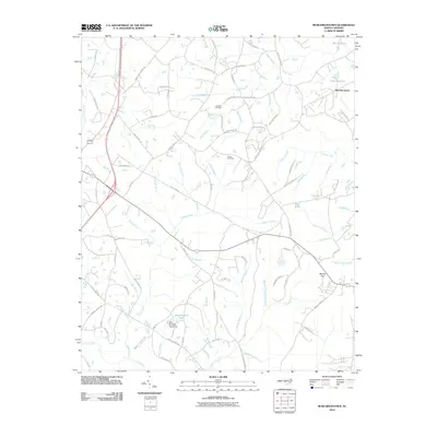
2010 Map of Murchisontown
USGS Topo · Published 2010About this map
Murchisontown sits at the northeastern corner of this landscape, an area characterized by a complex network of wetlands and small watercourses in central North Carolina. The terrain is defined by low-lying drainages including Beaver Creek, Juniper Creek, and the slow-moving waters of Gum Swamp. Notable landmarks such as Round Top provide modest elevation changes amidst the numerous branches and runs that feed into larger creeks.
Find a feature on this map
91 named features on this map. Tap any name to fly to it.
Don’t see what you’re looking for? This feature index may not catch every label — zoom into the map to look around manually.
Map Details
Editions of this 2010 Murchisontown Map
This is the sole edition of this map. No revisions or reprints were ever made.
Other maps of this area

1948 · Southern Pines
USGS Topo · 1:62,500

1948 · Clifdale
USGS Topo · 1:62,500

1950 · Lobelia
USGS Topo · 1:24,000

1950 · Niagara
USGS Topo · 1:24,000

1951 · Clifdale
USGS Topo · 1:62,500

1953 · Raleigh
USGS Topo · 1:250,000

1954 · Raleigh
USGS Topo · 1:250,000

1957 · Murchisontown
USGS Topo · 1:24,000

1957 · Southern Pines
USGS Topo · 1:62,500
1957 · Niagara
USGS Topo · 1:24,000