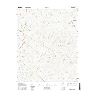
2016 Map of Murchisontown
USGS Topo · Published 2016About this map
Cameron and Murchisontown anchor this 2016 survey of the rolling Sandhills region where Lee, Moore, and Harnett Counties meet. The landscape is defined by an intricate network of drainage ways, including Butler Cr, Juniper Cr, and the three distinct branches of Upper Run, Middle Run, and Lower Run. These watercourses feed into wetlands like MacDonald Swamp and Gum Swamp, illustrating the hydrological complexity of the area north of Big Ridge.
Find a feature on this map
132 named features on this map. Tap any name to fly to it.
Don’t see what you’re looking for? This feature index may not catch every label — zoom into the map to look around manually.
Map Details
Editions of this 2016 Murchisontown Map
This is the sole edition of this map. No revisions or reprints were ever made.
Other maps of this area

1948 · Southern Pines
USGS Topo · 1:62,500

1948 · Clifdale
USGS Topo · 1:62,500

1950 · Lobelia
USGS Topo · 1:24,000

1950 · Niagara
USGS Topo · 1:24,000

1951 · Clifdale
USGS Topo · 1:62,500

1953 · Raleigh
USGS Topo · 1:250,000

1954 · Raleigh
USGS Topo · 1:250,000

1957 · Murchisontown
USGS Topo · 1:24,000

1957 · Southern Pines
USGS Topo · 1:62,500
1957 · Niagara
USGS Topo · 1:24,000