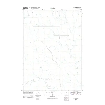
2012 Map of Murdo SE
USGS Topo · Published 2012About this map
The White River winds through the southern landscape of this 2012 survey, defining the topographical character of the Swift Bear Segment. This area of Mellette County is shaped by a series of drainage systems, including Spring Cr and Johnny Cr which feed toward the main river valley from the west, while the eastern portion is dominated by the course of Bull Cr. The infrastructure is typical of rural South Dakota ranching country, where a sparse network of section-line roads and county routes like Co Rd-s4 and Jones Co Hwy S9 provide the primary access to this open terrain. The map captures the hydrological patterns and high-plateau relief of the Missouri Plateau region before it descends toward the river breaks.
Find a feature on this map
8 named features on this map. Tap any name to fly to it.
Don’t see what you’re looking for? This feature index may not catch every label — zoom into the map to look around manually.
Map Details
Editions of this 2012 Murdo SE Map
This is the sole edition of this map. No revisions or reprints were ever made.
Other maps of this area

1951 · Murdo SE
USGS Topo · 1:24,000

1951 · White River NE
USGS Topo · 1:24,000

1951 · Westover
USGS Topo · 1:24,000

1951 · Badnation NW
USGS Topo · 1:24,000

1951 · Murdo SW
USGS Topo · 1:24,000

1955 · Martin
USGS Topo · 1:250,000

1958 · Martin
USGS Topo · 1:250,000

1970 · Vivian SW
USGS Topo · 1:24,000

1972 · Draper
USGS Topo · 1:24,000

1972 · Murdo
USGS Topo · 1:24,000