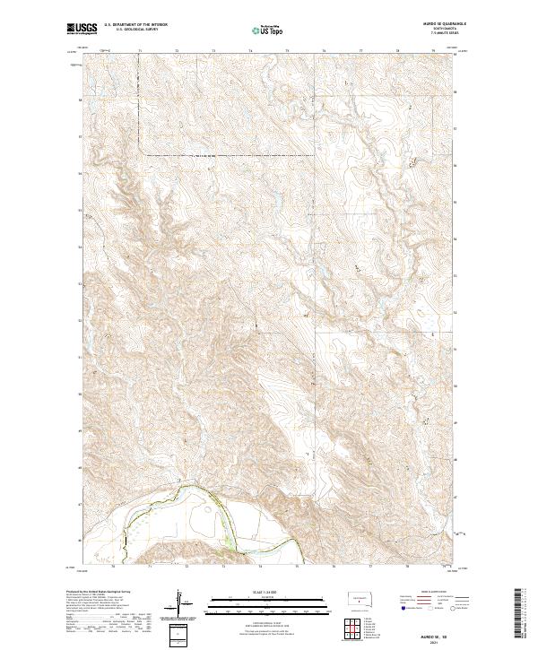
2021 Map of Murdo SE
USGS Topo · Published 2021About this map
The White River defines the southern boundary of this landscape, marking the border where Jones Co Mellette Co meet. This terrain is characterized by a high-density network of dendritic drainages including Spring Cr, Bull Cr, and Johnny Cr, which carve through the plains to feed the larger river system. The map reflects a classic rural township-and-range structure, with sparse infrastructure concentrated along corridors such as 279th Ave and Co Rd 56.
Find a feature on this map
14 named features on this map. Tap any name to fly to it.
Don’t see what you’re looking for? This feature index may not catch every label — zoom into the map to look around manually.
Map Details
Editions of this 2021 Murdo SE Map
This is the sole edition of this map. No revisions or reprints were ever made.
Other maps of this area

1951 · Murdo SE
USGS Topo · 1:24,000

1951 · White River NE
USGS Topo · 1:24,000

1951 · Westover
USGS Topo · 1:24,000

1951 · Badnation NW
USGS Topo · 1:24,000

1951 · Murdo SW
USGS Topo · 1:24,000

1955 · Martin
USGS Topo · 1:250,000

1958 · Martin
USGS Topo · 1:250,000

1970 · Vivian SW
USGS Topo · 1:24,000

1972 · Draper
USGS Topo · 1:24,000

1972 · Murdo
USGS Topo · 1:24,000