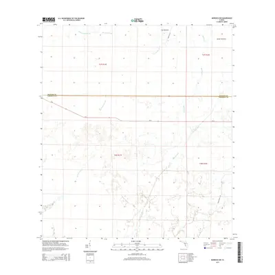
2015 Map of Murdock NW
USGS Topo · Published 2015About this map
Mossy Island Slough and Deer Prairie Slough dominate this low-lying landscape along the boundary between Sarasota and Manatee counties. The map illustrates a transitional environment where natural drainage patterns meet human infrastructure, notably the Big Slough Canal which cuts through the southern sections. Distinctive dry elevations or "hammocks," such as Cat Hammock and Messer Hammock, provide relief from the surrounding wetlands. This 2015 survey shows a largely undeveloped interior, with land management indicated by the grid of Walton Ranch Rd and Coker Gully Rd intersecting with the primary corridor of Sr-72. The geography here is defined by slow-moving water and seasonal drainage, characteristic of the Florida interior before significant residential expansion reaches these reaches of the slough systems.
Find a feature on this map
14 named features on this map. Tap any name to fly to it.
Don’t see what you’re looking for? This feature index may not catch every label — zoom into the map to look around manually.
Map Details
Editions of this 2015 Murdock NW Map
This is the sole edition of this map. No revisions or reprints were ever made.
Other maps of this area

1944 · Lower Myakka Lake
USGS Topo · 1:31,680

1944 · Myakka River
USGS Topo · 1:31,680

1944 · Miakka
USGS Topo · 1:31,680

1956 · Murdock
USGS Topo · 1:24,000

1956 · Myakka City
USGS Topo · 1:24,000

1956 · Edgeville
USGS Topo · 1:24,000

1956 · Murdock SE
USGS Topo · 1:24,000

1956 · Murdock NE
USGS Topo · 1:24,000

1956 · Murdock NW
USGS Topo · 1:24,000

1956 · Tampa
USGS Topo · 1:250,000