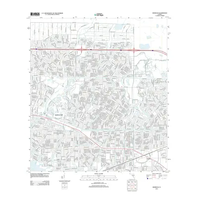
2012 Map of Murdock
USGS Topo · Published 2012About this map
North Port defines this portion of Southwest Florida, showcasing a dense network of residential streets arranged in the geometric patterns characteristic of modern Gulf Coast development. The landscape is oriented around the Big Slough and the nearby Little Salt Spring, highlighting the region's unique hydrology where freshwater systems meet the coastal plain. In the southeast corner, the community of Murdock sits near the confluence of major thoroughfares, while the Myakka River borders the southwestern edge of the quadrangle.
Find a feature on this map
40 named features on this map. Tap any name to fly to it.
Don’t see what you’re looking for? This feature index may not catch every label — zoom into the map to look around manually.
Map Details
Editions of this 2012 Murdock Map
This is the sole edition of this map. No revisions or reprints were ever made.
Other maps of this area

1944 · Lower Myakka Lake
USGS Topo · 1:31,680

1944 · Myakka River
USGS Topo · 1:31,680

1956 · Murdock
USGS Topo · 1:24,000

1956 · Murdock SE
USGS Topo · 1:24,000

1956 · Murdock NE
USGS Topo · 1:24,000

1956 · Murdock NW
USGS Topo · 1:24,000

1956 · Englewood
USGS Topo · 1:24,000

1956 · Tampa
USGS Topo · 1:250,000

1956 · Charlotte Harbor
USGS Topo · 1:250,000

1957 · El Jobean
USGS Topo · 1:24,000