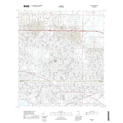
2018 Map of Murdock
USGS Topo · Published 2018About this map
North Port and the village of Murdock define this coastal Florida landscape at the boundary of Sarasota and Charlotte counties. The terrain is a complex network of residential subdivisions and engineered drainage, characterized by the Cocopum Waterway and numerous named streets that grid the flatwoods. Highlighting the area's natural hydrology and early points of interest, Big Slough and Little Salt Spring appear alongside the more southern reaches of the Myakka River. Significant local landmarks like Restlawn Memorial Gardens and the winding course of Sam Knight Creek provide essential reference points for understanding the development of this region as it transitioned from open land into a modern suburban corridor. Key transportation routes including Tamiami Trl and El Jobean Rd connect these growing communities across the landscape.
Find a feature on this map
42 named features on this map. Tap any name to fly to it.
Don’t see what you’re looking for? This feature index may not catch every label — zoom into the map to look around manually.
Map Details
Editions of this 2018 Murdock Map
This is the sole edition of this map. No revisions or reprints were ever made.
Other maps of this area

1944 · Lower Myakka Lake
USGS Topo · 1:31,680

1944 · Myakka River
USGS Topo · 1:31,680

1956 · Murdock
USGS Topo · 1:24,000

1956 · Murdock SE
USGS Topo · 1:24,000

1956 · Murdock NE
USGS Topo · 1:24,000

1956 · Murdock NW
USGS Topo · 1:24,000

1956 · Englewood
USGS Topo · 1:24,000

1956 · Tampa
USGS Topo · 1:250,000

1956 · Charlotte Harbor
USGS Topo · 1:250,000

1957 · El Jobean
USGS Topo · 1:24,000