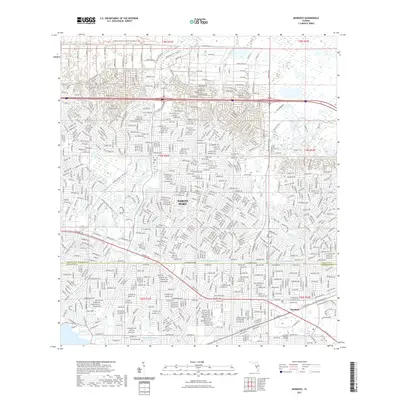
2021 Map of Murdock
USGS Topo · Published 2021About this map
North Port and the unincorporated community of Murdock anchor this Southwest Florida landscape, showcasing the dense residential platting and water management systems characteristic of the region's modern development. The intricate network of canals and drainage features, such as the Cocoplum Waterway and the meandering path of Big Slough, illustrates the engineering required to support the mid-to-late 20th-century population boom. These artificial waterways contrast with the preserved natural corridor of the T Mabry Carlton Jr Memorial Preserve Trl along the northern boundary.
Find a feature on this map
22 named features on this map. Tap any name to fly to it.
Don’t see what you’re looking for? This feature index may not catch every label — zoom into the map to look around manually.
Map Details
Editions of this 2021 Murdock Map
This is the sole edition of this map. No revisions or reprints were ever made.
Other maps of this area

1944 · Lower Myakka Lake
USGS Topo · 1:31,680

1944 · Myakka River
USGS Topo · 1:31,680

1956 · Murdock
USGS Topo · 1:24,000

1956 · Murdock SE
USGS Topo · 1:24,000

1956 · Murdock NE
USGS Topo · 1:24,000

1956 · Murdock NW
USGS Topo · 1:24,000

1956 · Englewood
USGS Topo · 1:24,000

1956 · Tampa
USGS Topo · 1:250,000

1956 · Charlotte Harbor
USGS Topo · 1:250,000

1957 · El Jobean
USGS Topo · 1:24,000