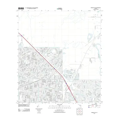
2012 Map of Murdock SE
USGS Topo · Published 2012About this map
Suburban residential growth defines this region of Southwest Florida, where an intricate network of streets expands toward the banks of the Peace River. This 2012 survey documents the transition of the landscape into a densely gridded community, anchored by transportation infrastructure and local recreational hubs. The massive corridor of I-75 slices through the territory, serving as a primary artery for the region's development. Local aviation and leisure are represented by the Lake Suzy Estates Airport and the Arcadia Municipal Golf Course, highlighting the area's modern character. Smaller thoroughfares like Cord 769 weave through the newer residential subdivisions, providing a clear record of the planned street layouts and local connectivity during this period of expansion.
Find a feature on this map
5 named features on this map. Tap any name to fly to it.
Don’t see what you’re looking for? This feature index may not catch every label — zoom into the map to look around manually.
Map Details
Editions of this 2012 Murdock SE Map
This is the sole edition of this map. No revisions or reprints were ever made.
Other maps of this area

1956 · Murdock
USGS Topo · 1:24,000

1956 · Murdock SE
USGS Topo · 1:24,000

1956 · Murdock NE
USGS Topo · 1:24,000

1956 · Cleveland
USGS Topo · 1:24,000

1956 · Ft. Ogden
USGS Topo · 1:24,000

1956 · Nocatee
USGS Topo · 1:24,000

1956 · Murdock NW
USGS Topo · 1:24,000

1956 · West Palm Beach
USGS Topo · 1:250,000

1956 · Tampa
USGS Topo · 1:250,000

1956 · Fort Pierce
USGS Topo · 1:250,000
Featured Places
- North Port, FL
- Heritage Lake Park Community Development District, FL
- Lake Suzy, FL
- Sidell, North Port
- Deep Creek, FL