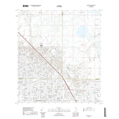
2018 Map of Murdock SE
USGS Topo · Published 2018About this map
North Port and Port Charlotte dominate the landscape of this 2018 survey, which captures the intricate street grids and canal systems of Southwest Florida. The map illustrates a highly developed suburban environment characterized by named residential corridors like Hillsborough Blvd and Veterans Blvd. The northern section remains more transitional, featuring wetlands and the small settlement of Platt near the eastern boundary. Hydrology is central to the area's layout, defined by the winding course of the Peace River and the artificial engineering of the Cocoplum Waterway. Aviation history and local transport are represented by the Lake Suzy Estates Airport, situated near the confluence of the Sarasota, DeSoto, and Charlotte county lines. The dense network of avenues and streets, from Skyway Ave to Ullrich Strasse, reflects the rapid late-20th-century expansion of these Gulf Coast communities.
Find a feature on this map
41 named features on this map. Tap any name to fly to it.
Don’t see what you’re looking for? This feature index may not catch every label — zoom into the map to look around manually.
Map Details
Editions of this 2018 Murdock SE Map
This is the sole edition of this map. No revisions or reprints were ever made.
Other maps of this area

1956 · Murdock
USGS Topo · 1:24,000

1956 · Murdock SE
USGS Topo · 1:24,000

1956 · Murdock NE
USGS Topo · 1:24,000

1956 · Cleveland
USGS Topo · 1:24,000

1956 · Ft. Ogden
USGS Topo · 1:24,000

1956 · Nocatee
USGS Topo · 1:24,000

1956 · Murdock NW
USGS Topo · 1:24,000

1956 · West Palm Beach
USGS Topo · 1:250,000

1956 · Tampa
USGS Topo · 1:250,000

1956 · Fort Pierce
USGS Topo · 1:250,000
Featured Places
- North Port, FL
- Heritage Lake Park Community Development District, FL
- Lake Suzy, FL
- Sidell, North Port
- Deep Creek, FL